- Home
- Electronics & Instrumentation
- SSB Marine Radio
- How Does a Marine GPS Work
How does a Marine GPS Work?
and other GPS-related questions
"How does a Marine GPS Work?" is one of the most commonly asked GPS-related questions on the internet. The answer is right here, along with a number of other Q&As asked by curious sailors...
How does a marine GPS work?
How does a marine GPS work?
Marine GPS receivers pick up signals from multiple satellites (part of the Global Navigation Satellite System - GNSS). By calculating the time it takes for these signals to arrive, the receiver determines its distance from each satellite. Using a process called trilateration (requiring signals from at least four satellites for a 3D fix – latitude, longitude, and altitude), the GPS unit calculates the precise location of the boat.
What do all the numbers and abbreviations on the GPS display mean?
What do all the numbers and abbreviations on the GPS display mean?
Common abbreviations include:
- LAT/LON: Latitude and Longitude, indicating the boat's geographical position.
- SOG: Speed Over Ground, the boat's speed relative to the seabed.
- COG: Course Over Ground, the actual direction the boat is moving over the seabed.
- BRG: Bearing, the direction to a specific waypoint or object.
- DST: Distance, usually the distance to a selected waypoint.
- ETA: Estimated Time of Arrival at a waypoint or destination.
- XTE: Cross-Track Error, the distance the boat is off the planned course.
- HDG: Heading, the direction the boat's bow is pointing (often from a separate compass sensor).
What is the difference between GPS, GLONASS, Galileo, and BeiDou?
What is the difference between GPS, GLONASS, Galileo, and BeiDou?
These are all global navigation satellite systems. GPS is the US system, GLONASS is Russian, Galileo is European, and BeiDou is Chinese. Modern marine GPS receivers often utilize signals from multiple systems to improve accuracy and reliability.
What are waypoints and routes? How do I create and use them?
What are waypoints and routes? How do I create and use them?
These are fundamental for planning and following a course.
- Waypoints: Specific geographical coordinates that mark a point of interest, a turning point, or a hazard. Skippers use them to define a route.
- Routes: A sequence of waypoints that define a planned path of travel.
- Creating: Most GPS units allow manual entry of coordinates, marking the current position as a waypoint, or selecting points on an electronic chart to add as waypoints to a route.
- Using: Once a route is activated, the GPS will guide the skipper along the sequence of waypoints, providing bearing, distance to the next waypoint, and cross-track error.
What are electronic charts (vector vs. raster)? What are the differences and which should I use?
What are electronic charts (vector vs. raster)? What are the differences and which should I use?
- Raster Charts: Digital images of paper charts. They are familiar but do not allow zooming without pixelation and have limited interactive features.
- Vector Charts: Composed of layers of digital data representing navigational features (depth contours, buoys, etc.). They allow seamless zooming, querying of objects, and integration with other instruments.
- Which to use: Vector charts are generally preferred for their flexibility and features, but raster charts can be a good backup and are sometimes preferred for their traditional appearance. Many modern chartplotters support both.
What is AIS and how does it integrate with my GPS?
What is AIS and how does it integrate with my GPS?
The Automatic Identification System (AIS) transmits and receives information about nearby vessels (name, course, speed, etc.). When integrated with a GPS/chartplotter, AIS targets are displayed overlaid on the electronic chart, enhancing situational awareness and collision avoidance.
How do I use the anchor alarm feature on my GPS?
How do I use the anchor alarm feature on my GPS?
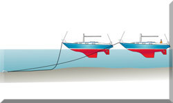
The anchor alarm allows you to set a virtual radius around your anchored position. If the boat drifts outside this radius (indicating anchor drag), an alarm will sound. To use it, you typically mark your position when anchored, set the desired alarm radius (taking into account the boat's length and potential swing), and activate the alarm.
Can my marine GPS receive weather information? How?
Can my marine GPS receive weather information? How?
Some advanced marine GPS units can receive weather information via various methods, such as:
- NMEA 2000 or NMEA 0183: Connecting to a compatible weather receiver (e.g., SiriusXM Marine, GRIB file receiver).
- Wi-Fi or Bluetooth: Connecting to a smartphone or satellite communication device with internet access.
- Built-in Satellite Weather: Some units have integrated receivers for specific satellite weather services.
How do I connect my GPS to other instruments like autopilot, depth sounder, and VHF radio? What are NMEA 0183 and NMEA 2000?
How do I connect my GPS to other instruments like autopilot, depth sounder, and VHF radio? What are NMEA 0183 and NMEA 2000?
- NMEA 0183: An older serial data protocol for marine electronics. It transmits data in one direction from a talker to one or more listeners.
- NMEA 2000: A newer, more robust network protocol that allows multiple devices to communicate bi-directionally on a single bus. It's generally easier to install and offers more bandwidth.
- Connection: Devices are connected using appropriate NMEA cables. The GPS typically outputs position, course, and speed data that can be used by autopilots, VHF radios (for DSC - Digital Selective Calling), and other instruments. Depth sounder data can also be integrated into the GPS display.
My GPS is not getting a satellite fix. What should I do?
My GPS is not getting a satellite fix. What should I do?
- Check antenna connection: Ensure the GPS antenna cable is securely connected to both the antenna and the GPS unit.
- Check for obstructions: Make sure the antenna has a clear view of the sky without any obstructions (e.g., bimini top, radar arch).
- Power cycle: Turn the GPS unit off and on again.
- Check antenna power: Some active GPS antennas require power. Ensure they are receiving power.
- Test mode: Many GPS units have a test mode that shows the number of satellites being tracked and their signal strength. Check this to diagnose antenna issues.
- Interference: Other electronic devices might be causing interference. Try turning them off temporarily.
My GPS position seems inaccurate. What could be the problem?
My GPS position seems inaccurate. What could be the problem?
- Insufficient satellite fix: Ensure the unit is receiving signals from at least four satellites.
- Poor antenna placement: Obstructions can degrade accuracy.
- Atmospheric conditions: Ionospheric and tropospheric delays can slightly affect accuracy.
- Dilution of Precision (DOP): The geometry of the satellites in the sky can affect accuracy. A lower DOP value indicates better accuracy.
- Magnetic interference (for COG/Heading): If the GPS is relying on a magnetic compass for course or heading data, nearby magnetic materials can cause errors.
- Chart datum mismatch: Ensure the chart datum of the electronic chart matches the GPS datum (usually WGS84).
My electronic charts are not displaying correctly or are missing details.
My electronic charts are not displaying correctly or are missing details.
- Chart card insertion: Ensure the chart card is properly inserted into the chartplotter with the contacts aligned.
- Water intrusion/corrosion: Check the chart card slot for any water or corrosion.
- Detail settings: Most chartplotters have settings to control the level of detail displayed. Ensure these are appropriately adjusted.
- Chart mode: Some units have different chart modes (e.g., navigation chart, fishing chart). Ensure the correct mode is selected.
- Software/chart updates: Ensure both the chartplotter software and the electronic charts are up to date. Outdated charts may have errors or missing information.
My GPS is losing signal intermittently.
My GPS is losing signal intermittently.
- Loose connections: Check all power and antenna connections.
- Cable damage: Inspect cables for any cuts, kinks, or damage.
- Power fluctuations: Ensure a stable power supply to the GPS unit.
- Interference: Temporary interference from other electronic devices or external sources might be the cause.
- Antenna issues: The GPS antenna itself might be faulty or have an intermittent problem.
Should I rely solely on my GPS for navigation?
Should I rely solely on my GPS for navigation?
No. While marine GPS is a powerful and valuable tool, it should not be the sole means of navigation. It's essential to practice traditional navigation skills (using paper charts, compass, bearings, etc.) and have backup systems in place in case of GPS failure. Electronic systems can fail due to power issues, antenna problems, software glitches, or satellite outages.
How often should I update my electronic charts and GPS software?
How often should I update my electronic charts and GPS software?
Electronic charts should be updated regularly, ideally at least annually, or more frequently if significant changes are known in your cruising area. GPS software updates often include bug fixes, performance improvements, and new features, so it's recommended to install them when available from the manufacturer.
What are some tips for effective use of a marine GPS on a sailboat?
What are some tips for effective use of a marine GPS on a sailboat?
- Understand your unit: Read the manual and familiarize yourself with all its features and settings.
- Plan routes carefully: Enter waypoints accurately and review the entire route on the chart before departure, zooming in to check for hazards.
- Use appropriate chart scales: Zoom in for detailed navigation in confined waters and zoom out for a broader overview.
- Monitor cross-track error: Stay on the planned route and be aware of any deviation.
- Use the anchor alarm: Always use it when at anchor, adjusting the radius appropriately for your boat and anchoring conditions.
- Be aware of GPS limitations: Understand that accuracy can be affected by various factors.
- Maintain situational awareness: Continuously compare the GPS data with visual observations and information from other instruments.
- Keep a logbook: Record important navigational information, including GPS positions, course changes, and any discrepancies.
- Practice with backup navigation methods: Regularly use paper charts and a compass to maintain these essential skills.
What should I do if my GPS system fails or provides inaccurate data? How can I troubleshoot common issues like signal loss or interference?
What should I do if my GPS system fails or provides inaccurate data? How can I troubleshoot common issues like signal loss or interference?
If your GPS system fails, start by checking the basics: ensure the device is powered on, the connections are secure, and the antenna is unobstructed. Signal loss can occur due to interference from nearby electronic devices, tall structures, or even dense foliage.
If you're in open water, move to a clearer area to regain signal. Atmospheric conditions, such as solar storms, can also disrupt GPS signals temporarily. To prepare for such scenarios, always carry paper charts, a compass, and a logbook to record your position and heading. Familiarize yourself with dead reckoning and celestial navigation techniques.
Additionally, consider investing in a handheld GPS as a backup. Regularly inspect and maintain your GPS equipment to prevent failures, and keep software updated to ensure optimal performance.
What are the best backup navigation methods or systems to use alongside GPS, such as paper charts or alternative electronic systems?
What are the best backup navigation methods or systems to use alongside GPS, such as paper charts or alternative electronic systems?
Paper charts remain a cornerstone of backup navigation. Learn to read and interpret them, and practice plotting courses manually. A compass and parallel rulers are essential tools for this.
Other electronic systems, like radar, AIS (Automatic Identification System), and depth sounders, can complement GPS by providing situational awareness and collision avoidance.
Mobile apps with offline maps, such as Navionics, can serve as additional backups.
Satellite navigation systems like Galileo and GLONASS can also be used alongside GPS for redundancy.
For long voyages, consider carrying a sextant and learning celestial navigation, which relies on the positions of stars, the sun, and the moon.
How can I set up a reliable navigation system on a budget? What are the essential components for safe sailing?
How can I set up a reliable navigation system on a budget? What are the essential components for safe sailing?
To set up a budget-friendly navigation system, prioritize essential components like a GPS device, paper charts, a compass, and a depth sounder. Handheld GPS units are cost-effective and reliable.
Multifunction displays (MFDs) that integrate GPS, radar, and AIS can be a good investment if you want to consolidate equipment. Look for refurbished or second-hand devices to save money.
Mobile apps like OpenCPN can turn a tablet or laptop into a navigation tool. Protect these devices with waterproof cases. Regular maintenance, such as cleaning connections and updating software, ensures reliability.
For safety, also include a VHF radio and an EPIRB (Emergency Position Indicating Radio Beacon) in your setup.
Recent Articles
-
Is An SSB Marine Radio Installation Worth Having on Your Sailboat?
Apr 14, 25 02:31 PM
SSB marine radio is expensive to buy and install, but remains the bluewater sailors' favourite means of long-range communication, and here's why -
Correct VHF Radio Procedure: Your Questions Answered
Apr 14, 25 08:37 AM
Got a question about correct VHF radio procedure? Odds are you'll find your answer here... -
VHF Marine Radio; Which One is Right for Your Boat?
Apr 14, 25 05:09 AM
If you're looking to buy a VHF Marine Radio the choice can be a bit overwhelming. So what should it be, a fixed VHF or a handheld VHF? Maybe one with AIS or GPS built in perhaps?
