- Home
- Sailing the Caribbean
- Caribbean Island Hopping
Caribbean Island Hopping: A Sailor's Guide to the Leeward Islands
In a Nutshell...
Sailing through the Leeward Islands, from Anguilla to Dominica, is a truly special experience. We're talking about consistent trade winds, protected anchorages, and a series of islands all just a day's sail from each other. This guide provides a detailed look at each island, offering practical advice on ports of entry, recommended anchorages, and what makes each spot a must-see. The key is to embrace the variety—from the tranquil, secluded cays of Anguilla to the lively nightlife of Sint Maarten and the rugged, volcanic landscapes of Dominica. It’s an adventure that offers glorious sailing and unforgettable experiences, all while avoiding the dreary European winter weather.
Table of Contents
A Sailor's Paradise: Why the Leeward Islands?
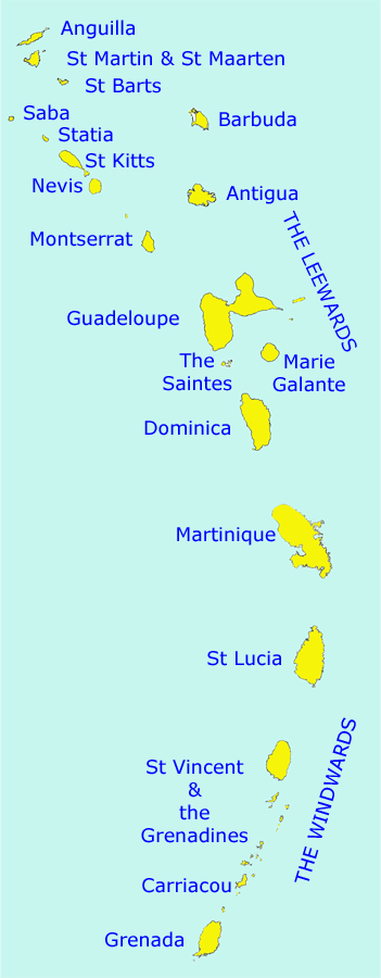
From my years of sailing in the region, I can tell you there are few, if any, cruising grounds that can compete with the Windward & Leeward Islands of the Eastern Caribbean. The Leeward Islands stretch from Anguilla in the north down to Dominica in the south, while the Windward Islands run from Martinique to Grenada.
But what makes these islands so special for a sailor? For starters, the constant warm north-east trade winds make for some truly glorious sailing. You'll find yourself gliding along on long ocean swells between islands, an experience that never gets old. The islands are perfectly spaced for day sails, making them an ideal island-hopping paradise.
On the western, or leeward, side of the islands, you'll find plenty of sheltered anchorages. If you're feeling more adventurous, you can sometimes find protection from the seas behind the reefs on the eastern side, though you won't get much shelter from the wind there. A particular favourite of mine is the beach bar scene—from haute cuisine to simple local food—and the friendly local people who make you feel so welcome.
And let’s not forget the rum! It’s a staple of the region and something you can’t help but appreciate. A sailing season that lets you escape the ice and snow of a European winter is a massive bonus, too. It’s a cruising ground that keeps you coming back for more.
Preparing for Your Adventure
Before you cast off, a few crucial steps will make all the difference to your trip. Having been caught out before, I can't stress enough the importance of being fully prepared.Provisioning for the Journey
You'll want to stock your boat with the essentials before you get too far south. While most islands have good grocery stores, the variety and prices can fluctuate. I've found it's best to buy your staples—pasta, rice, canned goods—in a larger port like Sint Maarten, where you have more options. When you arrive on a new island, make a point of visiting the local markets. It’s a great way to meet people and get a true taste of the local culture. Freshly caught fish, tropical fruits like jackfruit and mango, and local root vegetables like dasheen and yams are staples. Don’t miss the opportunity to try a local fish stew or roti from a small, family-run eatery.
The Indispensable Role of Charts & Pilot Books
I mentioned having your charts and pilot books to hand in the original draft, and for good reason. They are absolutely essential. Modern electronic charts and chart plotters are fantastic, but they should be a supplement to, not a replacement for, a good set of paper charts and a detailed pilot book. A pilot book for the Leeward Islands is a treasure trove of information that a plotter simply can’t offer: advice on tricky anchorages, specifics on entry procedures, and local tips on where to tie up the dinghy. I've often found that having the paper chart spread out on the table while planning a passage provides a better "big picture" view of the route, currents, and potential hazards. It's a practice that's saved me a few times.
Understanding Weather & Passage Planning
The Caribbean is a sailor’s dream thanks to the reliable weather, but that doesn't mean you can throw caution to the wind. The trade winds are consistent, but you need to know how to work with them.
The best time to sail is during the dry season, from December to April. During this period, you’ll typically have winds from the north-east blowing between 15 and 25 knots. This makes for exhilarating broad reaches when heading south, but be prepared for a solid beat when you're sailing north. You also need to be aware of the "Christmas winds," which can kick in with a vengeance around the festive season, bringing stronger, more northerly winds and bigger seas.
For passage planning, you should always check the forecast from multiple sources. I use a combination of local weather stations, GRIB files (digital weather forecasts that can be downloaded via satellite), and, crucially, local knowledge from other sailors on the VHF radio. Planning your passage to take advantage of the wind direction and to avoid heavy squalls is the mark of an experienced skipper. For a broader understanding of yachting in the region, from comprehensive pre-departure checks to in-depth weather planning strategies, you can refer to our complete guide, Sailing in the Caribbean: Information for Skippers & Crew.
Island Hopping the Leeward Islands
Let’s get our lines cast off and head south from Anguilla, the northernmost island in the chain.
Anguilla
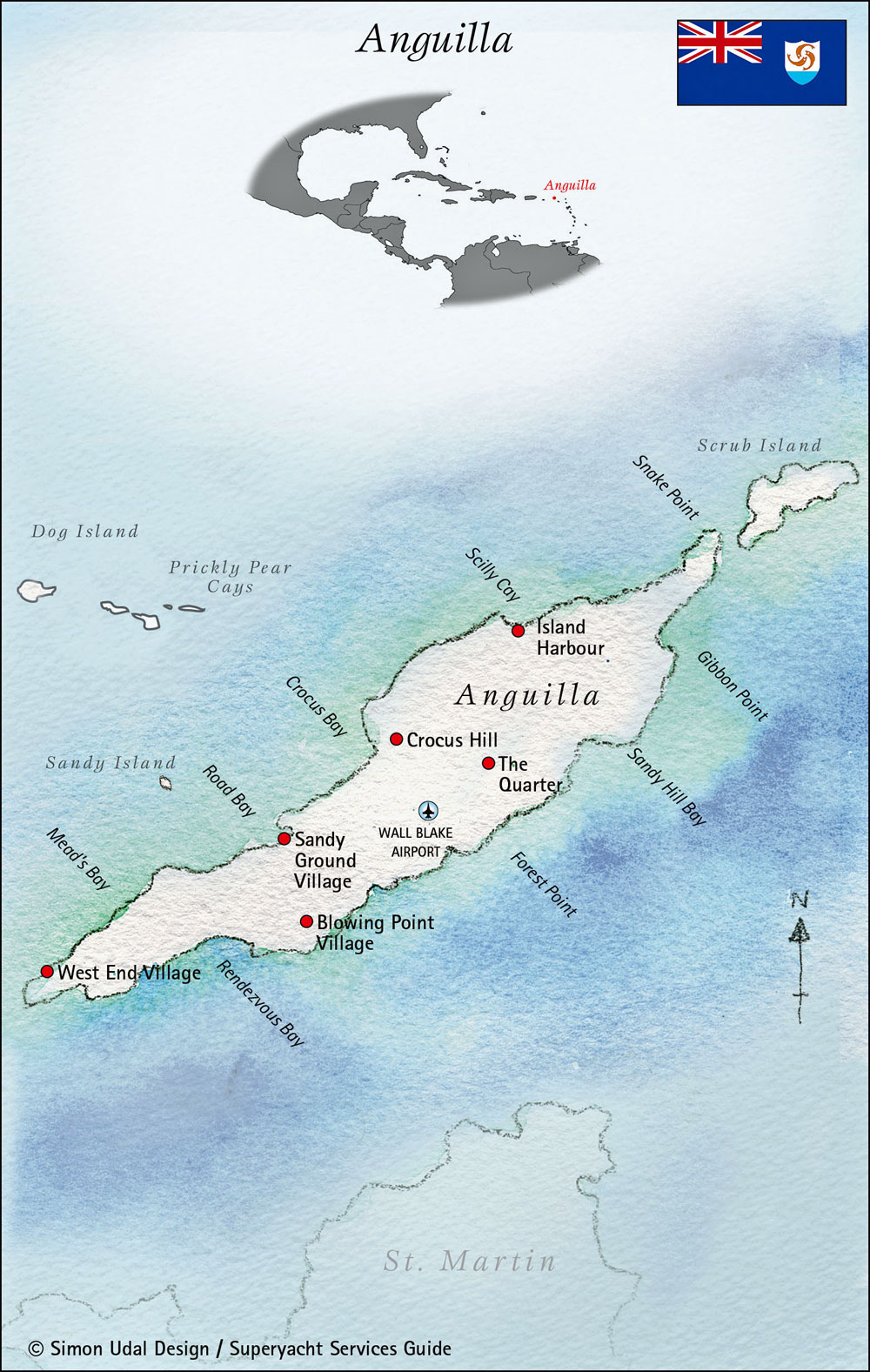
Discovered by Christopher Columbus in the 15th century, Anguilla was named for its shape—Anguilla means 'eel' or 'little snake' in Italian. This British Overseas Territory is home to a delightful mix of secluded spots and vibrant beach bars.
- Currency: Eastern Caribbean Dollars (EC$)
- Official Language: English
- Port of Entry: Road Bay
- Anchorages: Road Bay is the main anchorage, with Customs & Immigration offices conveniently located near the dinghy dock. Don't miss the small, exquisite cays to the north: Sandy Island and Dog Island offer beautiful day anchorages. However, be wary of the Prickly Pear Cays in swells or strong winds, as they can get uncomfortable. Be aware that overnighting here is prohibited, and you should give Scrub Island a miss entirely, as it has no suitable anchorage for yachts.
St Martin & Sint Maarten
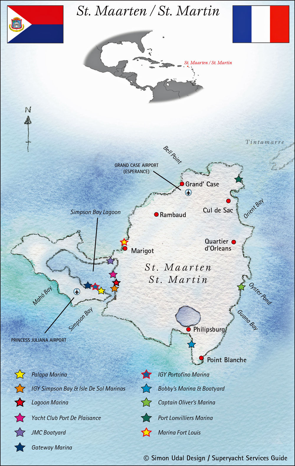
Just a short sail south lies the dual-nation island of St Martin (French side) and Sint Maarten (Dutch side). This island is a hive of activity and a stark contrast to the quiet charm of Anguilla.
- Currency: Euro (€) on the French side; Dutch Guilder & US$ on the Dutch side.
- Official Languages: French & English (French side); Dutch & English (Dutch side).
- Ports of Entry: Marigot (French side); Simpson Bay (Dutch side).
- Anchorages: Simpson Bay Lagoon is a popular spot, shared by both nations, with separate channels for entry. I remember one stormy night here where the holding was distinctly unreliable, an experience that will stay with me for a long time. The good news is the nightlife ashore, especially on the Dutch side, is incredibly lively.
St Barts (St Barthélemy)
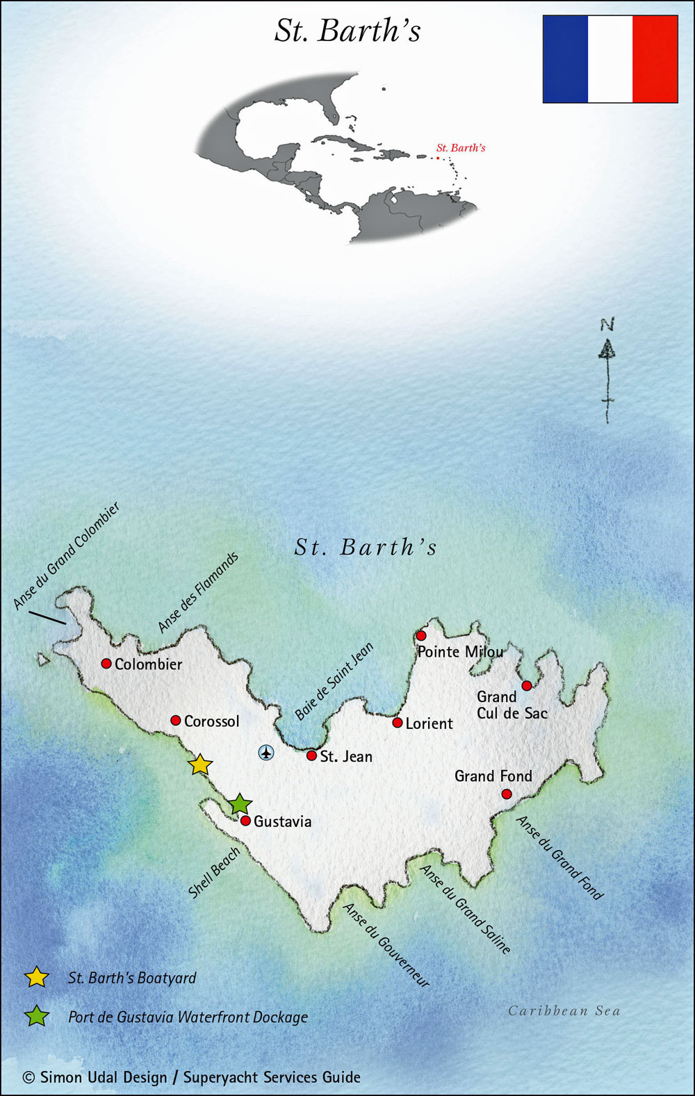
The sail southeast from St Martin to the French island of St Barts will likely be a beat. It's a challenging but rewarding passage.
- Currency: Euro (€)
- Official Language: French
- Port of Entry: Gustavia
- Anchorages: Head straight to Gustavia to check in. The French islands make this process a breeze. You'll be hard-pressed to find a dock, so anchor outside the harbour and dinghy in. You absolutely won't want to miss the anchorages at Anse du Colombier and Ile Fourchue. Both are excellent for snorkelling, and the latter offers a fantastic sense of solitude.
Saba
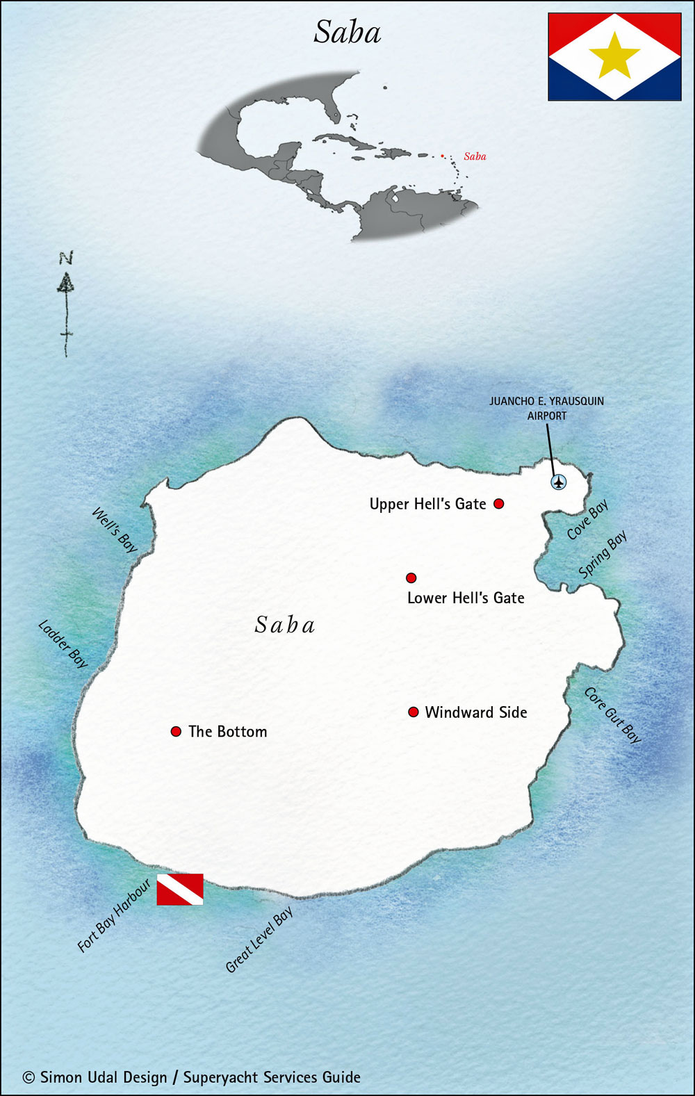
The small Dutch island of Saba is a truly unique destination.
- Currency: US Dollars (US$)
- Official Language: Dutch, with English and Spanish widely spoken.
- Port of Entry: Fort Bay
- Anchorages: The main anchorages are Well's Bay and Ladder Bay, where moorings are available. While there are also moorings at Fort Bay, they can be a bit exposed. A trip to the harbour in a small dinghy can be a challenge. Take it from me, an island tour of Saba is an absolute must. The island's topography is simply breathtaking.
St Eustatius (Statia)
Statia is a delightful island with one of the most notoriously rolly anchorages in the Caribbean.
- Currency: US Dollars (US$)
- Official Language: Dutch, but English is spoken everywhere.
- Port of Entry: Oranje Baai
- Anchorages: The anchorage at Oranje Baai is infamous. My wife Mary and I once picked up a mooring there, enticed by a "buy two nights, get the third free" offer. After two sleepless nights, we gratefully moved on! Despite the anchorage, the island itself is lovely. Hiking to the summit of the dormant volcano, 'The Quill,' is a must. A well-marked trail leads to the crater rim, where you can look down into its lush interior.
St Kitts & Nevis
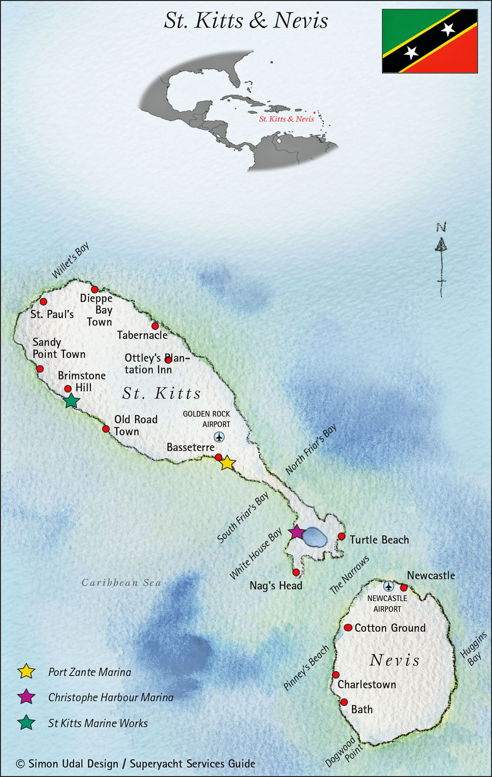
This two-island nation, independent since 1983, remains within the British Commonwealth.
- Currency: Eastern Caribbean Dollars (EC$)
- Official Language: English
- Ports of Entry: Basseterre (St Kitts); Charlestown (Nevis)
- Anchorages: On approach, St Kitts’ dense rainforest-covered mountain range is a prominent sight, providing a perfect home for the large population of African green vervet monkeys. The best anchorages in St Kitts are in the south, but they can be uncomfortable if there's any southerly wind. In those conditions, the Porte Zante Marina at Basseterre is a safe bet.
- Ashore: St Kitts has the Caribbean's only operating railway, a remnant of its sugar cane industry, which is now a popular tourist attraction. Don't make the same mistake my wife and I did—we went on a day with no cruise ships, only to find the train doesn't run then! Just across 'The Narrows' is Nevis, where moorings are plentiful off Pinney's Beach. Ashore, you can enjoy wonderful rainforest walks where monkeys abound.
Montserrat
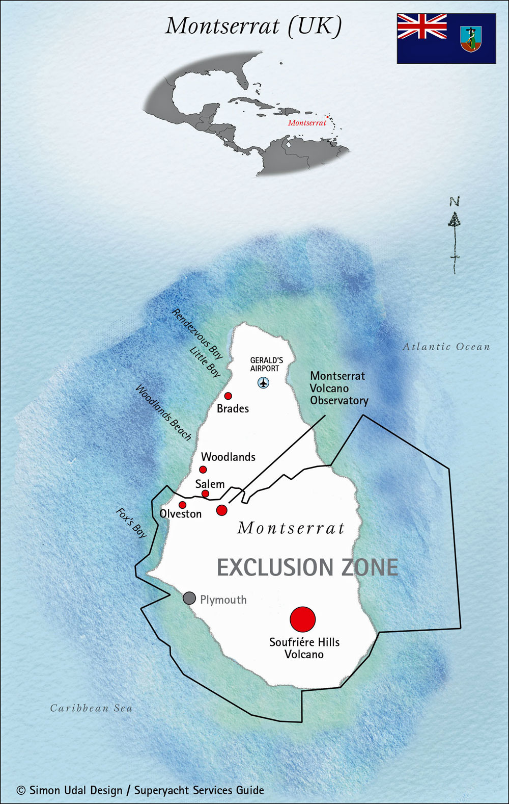
After the volcanic eruptions in 1985, Montserrat has gained the nickname 'The Emerald Isle' for its lush landscapes. Sailing down the windward (eastern) side is a good idea to avoid volcanic ash.
- Currency: Eastern Caribbean Dollars (EC$)
- Official Language: English
- Port of Entry: Little Bay
- Anchorages: Little Bay is the only port of entry and offers a reasonable anchorage. Hiring an island tour guide is a must; they can take you on hiking trails into the rainforest to see a multitude of tropical birds and plants. It’s a unique, memorable experience.
Antigua & Barbuda
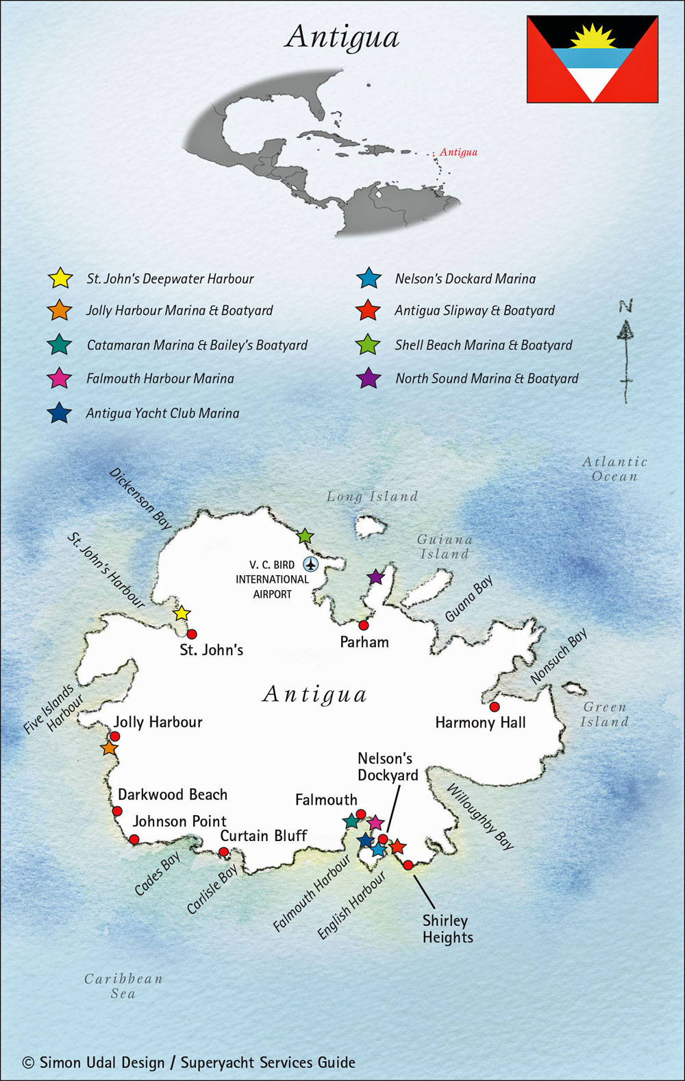
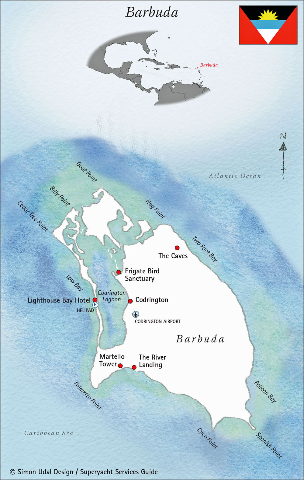
Antigua & Barbuda became an independent country within the British Commonwealth in 1981.
- Currency: Eastern Caribbean Dollars (EC$)
- Official Language: English
- Ports of Entry: English Harbour, Jolly Harbour
- Anchorages: If you had to choose just one island to cruise, Antigua would be it. It has more anchorages than any other in this chain, from the crowded hubs of English Harbour and Falmouth Harbour to the serene, peaceful seclusion of Great Bird Island, a personal favourite.
- Barbuda: Sadly, Barbuda was hit hard by Hurricane Irma in 2017. The storm breached the long, 11-mile white-sand beach, creating a channel into the lagoon. This allows for easier dinghy access to the town of Codrington and the world-famous frigate bird colony. Most cruisers anchor off the 11-mile beach, near the Old Boat Harbour, or in the reefy spots between Cocoa Point and Spanish Point.
Guadeloupe
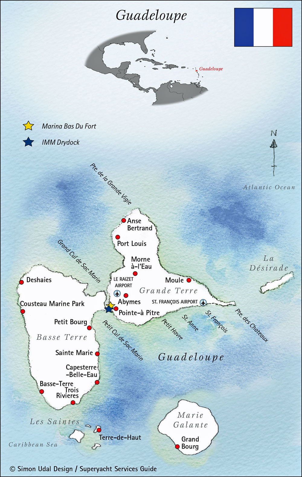
Guadeloupe is a French archipelago consisting of four main islands: Guadeloupe, Marie-Galante, La Désirade, and Les Îles des Saintes.
- Currency: Euro (€)
- Official Language: French
- Ports of Entry: Deshaies, Basse Terre, Pointe a Pitre, Les Saintes, Marie Galante
- Anchorages: The picturesque fishing village of Deshaies is the northernmost anchorage on the east side. To the south, Pigeon Island and the Cousteau Marine Park are a snorkeller’s dream. Les Saintes is a delightful group of islands where anchoring can be tricky due to deep waters, so arriving early for a mooring is a good idea. Visiting Marie Galante from Les Saintes can be a beat, so a more comfortable sail is from Pointe-a-Pitre.
Dominica
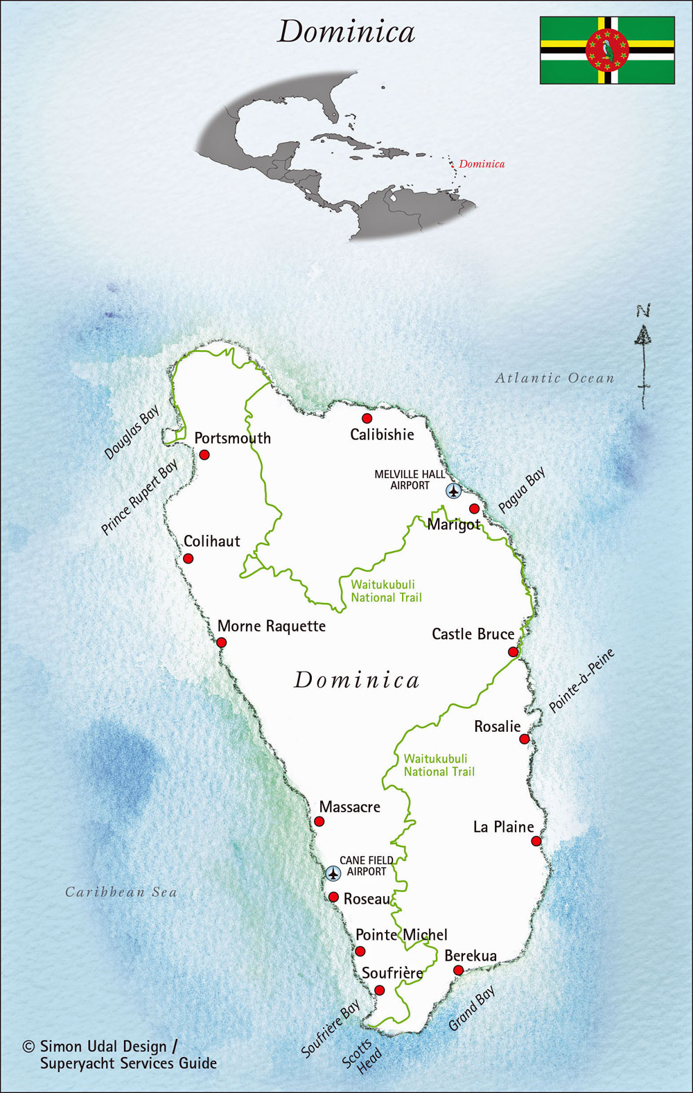
The 'Nature Island,' Dominica is the southernmost of the Leeward Islands and a truly special place.
- Currency: Eastern Caribbean Dollars (EC$)
- Official Language: English
- Port of Entry: Portsmouth and Roseau
- Anchorages: As you approach Portsmouth in Prince Rupert Bay, a local boatman will likely greet you and help you find a mooring. Take their recommendation for an island tour—it’s an opportunity you shouldn’t pass up. A quiet, non-outboard boat trip up the Indian River is an unforgettable experience.
The above sketch-maps of rhe islands are reproduced here with the kind permission of their creators, 'Superyacht Publications Ltd', and are taken from their super-useful Superyacht Services Guides for the Caribbean in which they make recommendations for all yachting services in each of the islands.
A Note on Culture & Etiquette
Having sailed these waters for years, I've come to appreciate the unique cultures of each island. Caribbean people are incredibly welcoming, and a little politeness goes a long way. Simple things like a friendly "good morning" or "hello" can open doors. Remember that many islands, especially those with a strong British or French heritage, value a more formal and respectful approach. Dressing modestly when you’re away from the beach, particularly in religious places or official buildings, is also a sign of respect. These small gestures make all the difference and help you connect with the local community in a meaningful way.
Summing Up
Island hopping through the Leeward Islands is an unparalleled sailing adventure. The journey from Anguilla to Dominica offers a remarkable diversity of experiences—from tranquil, secluded cays and pristine beaches to vibrant, bustling towns and dramatic volcanic landscapes. The consistent trade winds make for excellent sailing, and the short distances between islands allow you to truly immerse yourself in the unique culture, cuisine, and natural beauty of each destination. It’s a cruising ground that keeps sailors coming back, time and time again.
This article was written by Dick McClary, RYA Yachtmaster and author of the RYA publications 'Offshore Sailing' and 'Fishing Afloat', member of The Yachting Journalists Association (YJA), and erstwhile member of the Ocean Cruising Club (OCC).
FAQs
When is the best time to go sailing in the Leeward Islands?
When is the best time to go sailing in the Leeward Islands?
The best time is during the dry season, from December to April. You'll get consistent north-east trade winds and less chance of tropical storms, making for excellent sailing conditions.
Do I need to check in at every island?
Do I need to check in at every island?
Yes, you must clear in and out of Customs & Immigration at the official Port of Entry for each new Island Nation you visit. Each island has its own procedures, so it’s wise to check your pilot guide for the latest information.
What are the typical sailing conditions between the islands?
What are the typical sailing conditions between the islands?
Expect consistent north-east trade winds, typically between 15-25 knots. The passages are generally open ocean on long swells, which makes for exhilarating sailing. It can be a beat on some legs, especially when heading east or south-east.
How much do yacht services and marinas cost?
How much do yacht services and marinas cost?
Costs vary significantly between islands. French islands like St Barts and Guadeloupe generally use the Euro (€) and can be more expensive. In comparison, islands using the Eastern Caribbean Dollar (EC$) or US Dollar (US$) may be more affordable. It's best to budget a few hundred dollars per week, depending on your yacht's size, for moorings, docking, and services.
Are the anchorages safe in the Leeward Islands?
Are the anchorages safe in the Leeward Islands?
Most anchorages on the leeward (western) side of the islands are well-protected from the prevailing easterly winds and seas. However, in southerly or northerly swells, some anchorages can become uncomfortable or even untenable. Always check your pilot guide and local knowledge for the best and safest spots.
Recent Articles
-
Beneteau Oceanis 331 Clipper Review: Specs, Performance & Ratios
Feb 04, 26 07:25 PM
A comprehensive review of the Beneteau Oceanis 331 Clipper sailboat. We analyse design ratios, interior layout, and performance for prospective cruising owners. -
Self-Tacking Headsails: Track Systems vs Hoyt Jib Booms
Feb 03, 26 06:26 AM
Master the mechanics of self-tacking headsails. We compare traditional club-footed rigs, curved tracks, and the superior Hoyt Jib Boom for offshore sailing. -
Catalina 42 mk1 Review: Specs, Performance & Cruising Analysis
Feb 01, 26 06:35 AM
An in-depth review of the Catalina 42 mk1 sailboat. Explore technical specifications, design ratios, and practical cruising characteristics for this iconic cruiser.